|
Between the first settlement after 1653 and the end of the Second Esopus War in 1664 the Dutch continually appropriated the cleared land the Indians had used as their age-old plantations. With the advantage of this land ready for the plow the “granary” of the Esopus territory staged itself to be the most productive in all of the New World. This was impressive enough to become the main cause of an end to Dutch rule and for the New Netherlands to become English in 1664.
The Dutch and the English were rivals for the trade of the slave-produced sugar from their respective Caribbean island plantations. When the English Crown was restored to Charles II in 1660 there was an immediate need to restore also the treasury. Appropriating a much needed food source for the growing numbers of slave workers of the English plantations while depriving the Dutch of the same source for their competing plantations was the solution.
In March of 1664 Charles II officially annexed New Netherlands as a British province and granted it to his brother James, Duke of York and Albany, as Lord Proprietor. The English had "sea to sea" claims of the entire east coast of North America based on John Cabot's 1498 voyages. With a fleet under the command of Sir Richard Nicolls the Dutch colony was seized and by late September, 1664 New Netherlands had become New York.
Within a month of his arrival Nicolls placed a garrison of English soldiers in "The Esopus", as the territory of Kingston was known to the Dutch. As this was just at the end of the Second Esopus War the peace was confirmed as the “Nicolls Treaty”. The terms of this treaty and the disposition of the English soldiers at Esopus punctuated the fact that the Dutch and the English were at war. The Esopus Indians were treated as allies against the Dutch and their rights were considered of equal or greater importance than those of the Dutch inhabitants of Esopus. This attitude toward the average Dutch inhabitant by the English continued well after the hostilities between the two nations in Europe ceased.
Since the principal reason for seizing the colony was the grain production of the Esopus, priority was placed on stabilizing this settlement and encouraging its productivity. The placing of as many farmers as possible immediately onto the tillable fields was the policy behind granting deeds.
The ceded lands of the Nicolls Treaty were basically those disputed lands that had caused the Second Esopus War. These were around Hurley and southwest following the Esopus Creek. In 1668 Nicolls named these the first and second “Great Piece” and proposed their division into 30 acre tracts with separate house lots in a village and the remainder of the wooded land as a commons. 1669 the British governor that replaced Nicolls, Francis Lovelace, had these lands surveyed, divided into lots and distributed between the English soldiers of the garrison that arrived with the seizure from the Dutch. At the same time he confirmed the bounds of the many farmlands of the founding settlers of the Esopus and the occupied Nieuwe Dorp (Hurley) lands.
With the completion of this survey, official English “Towns” to be governed under “Dukes Law” were established for the new and existing population centers. Wiltwyck was made into a Town and re-named Kingston. Nieuwe Dorp became the Town of Hurley. South of Hurley a new center was created and called the Town of Marbletown.
Between the introduction of the English garrison in Wiltwyck and this creation of the Towns in 1669 there was continual conflict between the Dutch planter population and the English soldiers. With the Nicolls proposal for distribution of the ceded lands in 1668 the germ of an ethnic division appears. The English are to settle southwest of Hurley and the Dutch from Groote Esopus (Kingston), north. When the court of Kingston in 1669 confirmed a settlement area as a precinct of Kingston at the convergence of the Plattekill and Esopus creeks this is the first recorded land grant north of Kingston into the area that will be the town of Saugerties. This grant carried the name “Dutch Settlement” well into the 20th century.
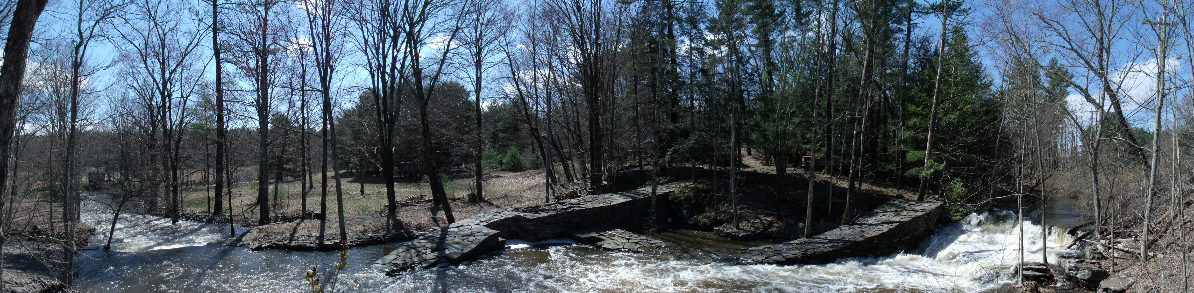
This northward expansion begins on April 9th, 1669, when a permit is given to construct a mill at a place called “Dead Men's Bones” located a mile above the “footpath leading to Albany” crossing of the Plattekill. At the same session of the court granting this mill site the farm fields below it at “a certain neck of land five miles distance from Kingston and over the Kill near the footpath leading to Albany containing about 54 acres of good and clear land” was also granted provided that all the grantees build their houses together “on the other side of the Kill due north from the land of Thomas Chambers” so as to make a “township within the precinct of Kingston”. This “township” is today Ruby on the Ulster side, and Plattekill on the Saugerties side of that Plattekill crossing.
The “township” was centered on the innship of Jan Burhans, a commissary of Kingston, and Jan Oosterhaut. The mill was that of Tjerck Claesen de Witt, also a Commissary, and Willem La Montagnie, the teacher in Kingston and its Secretary of the Court. These are all prominent Dutch names well established before the English period.
A noteworthy inclusion in this “Dutch Settlement” grant is the “desire” of Thomas Chambers, the most pre-eminent of the original planter class (and of English ancestory), to build a house for a servant and one for his "son-in-law" (possibly meaning his step-son of Dutch ancestory) in this same neighborhood. Thomas Chambers was to receive a manorial charter on October 16th, 1672 under the title of the “Lordship and Manor of Foxhall”. This “considerable Estate” was later enlarged yet more with the granting of an additional 300 acre tract in 1686. The bounds of this manor have never been precisely defined so the wording of the 1669 “Dutch Settlement” grant may be an indicator of its extent beyond the farm lands he first plowed as founder of the original Esopus settlement fifteen years earlier. The locations and periods of Thomas Chambers' acquisitions may also be taken as guideposts to a course of events that forms the northward expansion of the original planter class of the Groote Esopus.
In the early stages of this northern expansion the Groote Esopus experienced a brief return to Dutch rule. In the summer of 1673 New York was taken by Anthony Clove under the flag of William III of Orange, Stadholder of the United Netherlands. New York was again New Netherlands until early fall, 1674, with the arrival of New York's new governor, Edmond Andros, Lord Salisbury, representing James, Duke of York, after the Treaty of Westminster. With this treaty the Dutch and the English were no longer at war, the colony was once more English and the peace meant the garrison at Kingston was permanently disbanded. By 1677 the earliest claims of the original Dutch inhabitants of the mid-Hudson valley were finally recognized and confirmed as deeds and new patents were being granted over the entire region.
At this time the Court of Kingston, which was comprised mostly of Dutch planters, sought the surrender of all the Esopus Indian land that remained both south in the New Paltz area and north in the Saugerties area. The Lenne Lenapes, further threatened by the agreements between Andros and the Maquas during the Indian wars in Massachusetts in 1675-76, supported the final transfer of any remaining Minsi land to the English. On April 27, 1677, the Warranawonkong (the protector of the Lenne Lenape Esopus territories) released to Governor Andros all their rights to the northern territory of the Esopus. The following day Andros gave a license to twelve individuals to purchase from the Indians their remaining southern lands around New Paltz.
By 1683 the entire colony of New York comprised 10,000 inhabitants. 3,000 lived in and around Manhattan and 2,000 lived in the Esopus with the rest scattered in the Albany area and in the towns of Long Island. The grain shipped from the colony to the plantations of the Indies was 60,000 bushels, all ground, packaged and transported by the population of Manhattan but mainly grown in the Esopus fields of Kingston. With this increase in commerce bringing in more population the colony's new governor, Thomas Dongan, was directed to organize New York into administrative districts.
In 1684 the colony of New York was divided into 12 counties in which “corporations” and “Manors” were the governing bodies and “Patents” were the ownership deeds. The original County of Ulster was described as the land containing "the towns of Kingston, Hurley, Marbletown, Foxhall and the New Paltz, and all the villages, neighborhoods, and Christian habitations on the west side of the Hudson's River, from the Murderer's Creek, near the Highlands, to the Sawger's Creek.”
James, Duke of York, became King James II in early 1685 with the death of his brother, Charles II. This immediately made his proprietary colony into a Crown colony. Those with influential relationships in the court of the king immediately began to petition for patents to the newly available Crown lands. George Meales and Richard Hays petitioned the Crown for a patent to lands in the "Sagiers" in 1685. These lands totaled 1,194 3/4 acres. At about the same time another large patent petition was placed for 797˝ acres to the north at a location called Wanton. The petitioner was Robert Fullerton who was also the surveyor for the Meales and Hays lands. Finally, the largest petition was made in 1686 by William De Meyer and Jan and Mattys Mattyson representing 12 individuals in all. This was subsequently granted in 1688 as the northern part of the much larger Kingston Patent. That petition essentially covered all the lands of the Andros Treaty with the rest of the Kingston patent lands stretching all the way south to the New Paltz patent. On May 31, 1687 the Meales and Hays patents were granted. The Fullerton Patent was granted on January 9, 1692. These were probably at the time considered to be in the County of Albany as the Kingston Patent was the northern-most grant in the County of Ulster.
|
|
Standing out in a political system dominated by family “lordships” is a great legacy to democracy; a representative body of landholders that was influential in the provincial assembly and continued in self government throughout the provincial period, the Revolution and into early New York State history. This was the Corporation of Kingston; the Kingston Commons; the oldest corporate charter in New York State; bearing a royal council seal of 1688.
The Kingston patent was granted as the Town of Kingston. The planters and millers of the Dutch Settlement “precinct” of Kingston petitioned Governor Dongan in 1686 to have these lands and all the land north to the Albany county line made into a single patent along the lines of the one granted by Governor Andros to the New Paltz “Duzine” (12 founding settlers) in 1677. Instead Dongan did a grant structure that was unprecedented for the time. All of the Andros Treaty lands along with those south of the Rondout to the New paltz patent and east of the town of Hurley were consolidated into one large patent putting it under the estate and governance of “one body corporate and politique to be called by the name of the Trustees of the Freeholders and Commonality of the Town of Kingston.” The patent was granted May 19, 1687 and the establishment of the Corporation of Kingston was ratified by council May 17, 1688.
The royal charter for the Corporation of Kingston called for the election of twelve Trustees each year on the first Tuesday in March. These Trustees thus became responsible for all of the governmental functions of the now greatly expanded town of Kingston. This made Kingston the first of only a dozen-odd communities ever incorporated as self-governing entities in English America.
Two of the first “freeholds” deeded out of the land of the Corporation of Kingston were to the 1686 Philip Wells surveys of 86 acres for Peter Winne and 87 acres for William deMeyer, both in the Plattekill/Mount Marion part of the present town of Saugerties. The deMeyer grant was later expanded further by an 800 acre grant in 1688.
Confirmation deeds to the many Dutch Settlement lands watered by the Plattekill in the area of Saugerties were also given. A 1686 Philip Wells survey of 186 3/4 acres north of the land of William Legg confirmed the long occupied Innship of Jan Burhans and Jan Oosterhout. Most of the Dutch Settlement lands were occupied by the founding and first-to-serve Trustees of the Corporation: Dirick Shepmous, William deMeyer, Jacob Ruttsen, Wessel TenBrooge, Barrett Aertze, Tunis Jacobsen, Benjamin Provoost, William Legg, Jacob Aertsen, Mattyse Mattise, William Haines and John William Hooghteen.
The land north of these Dutch Settlement deeds is known as the “Churchland”. The Dutch Reformed Church had always been, since a strict directive by Peter Stuyvasant in 1664, responsible for orphans and the poor. This was also a function of the Corporation’s charter and so the solution was to use the crop yield of the Churchland to support the church. Thus the central valley or “great meadow” of Saugerties was early cleared and planted as a common activity of the “Commonality of Kingston” and became the first lands to be worked as a “common”.
Another responsibility of the Corporation was the maintenance of roads and bridges. The relationship of the earliest deeds to the roadbed of the “public road to Albany” (the Burhans/Oosterhout and the deMeyer grants as examples) essentially placed this maintenance responsibility on individuals as an exchange for ownership. The Trustees of the Corporation of Kingston, from the earliest deed transaction, used their stewardship over the land to expand and solidify their community. The vast majority of the Kingston Patent was maintained by them as a true commons; as a source of the everyday necessities of the "Freeholders and Commonality of the Town of Kingston".
The language used in creating the Corporation of Kingston had a special meaning in English law. Being a “freeholder” was distinct from being a freeman or Commoner. A commoner was any person who enroled to vote as resident of the Corporation by paying a modest fee and swearing an oath of loyalty. The higher rank of freeholder was by provincial statute reserved for a person owning real property valued at 40 pounds in the location where they voted. The important distinction is that through simple residence either freeholders or commoners had the right to vote in the Corporation of Kingston and by this right the “Rights and Privileges of Englishmen” were being recognized. This was rare in English America.
All other persons living in or visiting the Corporation were termed “strangers”. The Trustees protected the rights of the freeholders and commonality to their common property by regulating the "strangers" that could enter the commons. As early as 1689 the captains of vessels that brought strangers to the Kingston Patent lands could be fined if they did not register their passengers with the Trustees.
In a regulation of 1721 the Trustees stated that "no stranger shall set up trade or occupation in the Corporation" without a payment of 3 pounds for the "freedom". This, in essence, was setting the fee for becoming a member of the Corporation. There was a fee of 5 pounds placed by the trustees on the transporting of "wood, brush, stone, lime, tar or charcoal" from the Commons by those who did not have this “freedom” and this is partly how the Trustees maintained their treasury.
The Corporation of Kingston common lands were open, unrestricted, to all residents. The only land that was sold was specifically and obviously that which could be used to sustain a homestead or a plantation. The hillsides and other uncultivable areas adjacent to lands that were sold did not have to be owned. The owner of a farmstead already had the right to use them as a part of the Commons. Since everyone else that was a freeholder or commoner also had this right, the deeds from the Trustees that described private property reserved access to the common resources across the deeded lands: early forms of public easements.
The early deeds in the Saugerties Region described the best lands for farming and planting. The entire logic of ownership of private property within the Commons was that a homesteader had the right to own the land that he could improve to make it productive. The improvement of land encouraged settlement in the countryside and this was promoted openly by the Trustees. The wild lands that could not be improved supplied such necessities as firewood, timber, building stone and grazing for sheep, pigs and cattle and this not only benefitted the homesteaders but also the village dwellers who often owned animals and paid herders to take them to the commons.
The Trustees also encouraged settlement through social and economic policies. They negotiated prices for lands on a sliding scale based on ability to pay. They did the same for the interest on loans that they made from the considerable treasury that they accumulated from these sales. When they made a "loan" to a church it was more of a grant. A wealthy person seeking a loan paid 8 percent while a poor person paid six, and often five percent. There was a written policy that the wealthy were not to be given the advantage of borrowing at low interest just so they could profit from re-circulating the money at a higher interest.
The Trustees were the bankers, constables and justices of the community. These positions represented the same structure that was found in the Manor Systems that surrounded them. The Livingston, Cortland, Rensselaer, Beekman and other families that held the patents on all sides of the Kingston Patent held the same authority over the settlers on their lands as the Trustees. However, the difference in the systems is that the granting of the Kingston Patent established the annual election, by the freeholders, of their "lords". These Trustees, all twelve of them, were up for re-election every year. The only electoral advantage any one had over another was in having multiple distinct Freeholds allowing more than one vote. Otherwise, the position was based on merit and community standing.
We can assume that the actions of the Trustees and the system that was established in the Kingston Commons represented the will of the majority of the people of New York at the time. Ulster County was to become rapidly the most populace and broadly settled county in the Hudson Valley with the Corporation of Kingston as its center of population. The advantage of living in the Commons and the sense of freedom and community that this system represented instilled in its settlers the expectations that would lead to demands for a fuller system of like liberty and rights throughout the rest of the Hudson Valley and beyond.
|