This is an interpretive map that places the events of the journal of Henry Hudson's "Half Moon" kept by his first mate, Robert Juet, marking the locations where each journal entry happened on the Half Moon's sail up and down the Hudson river.
This interpretation is made from reading the distances in the entries, and is inspired by an article in "The Pearl" in 1875 by the authority of the time, Benson J. Losing. This highly obscure analysis is only published once, in The Pearl, and never found its way into the well known assumptions that are still recognized from being framed around the 1906 tricentennial placement of these journal events.
The composition below the PDF quotes the Lossing article and supports its findings by showing how he came to his conclusions.
This is a web production of Michael Sullivan Smith. It's distributed free of commercial or government platforms from the Cloud. If you find it informative you may be a patron by visiting the Patreon.com link on this introduction page. There you will find a list of interesting creations such as this to add to your electronic collection.The file burns a lot of bandwidth every time it is pulled down from the cloud. Patrons help me pay for this service so that you can save this file from the cloud into your computer. The PDF from this streaming file can be downloaded to your computer. The only good thing to come out of commercial dominance of the Internet is the power it needed in your personal computer to pull off this dominance. Please use what you have and save energy. Save the PDF to your computer if you're going to study this file.
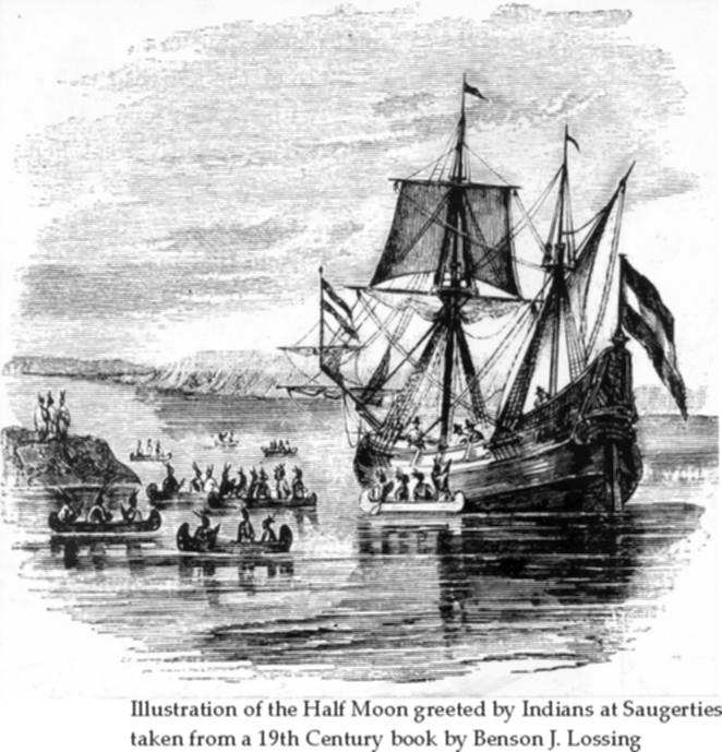
Henry Hudson at Saugerties
|
"The fiue and twentiuth was faire weather, and the wind at Sovth a stiffe gale. Wee rode still, and went on land to walke on the west side of the Riuer, and fovnd good grovnd for corne, and other garden herbs, with great store of goodly Oakes, and Walnut trees, and Chestnut trees, Ewe trees of sweet wood in great abvndance, and great store of Slate for hovses and other good stones. The sixe and twentieth was faire weather, and the wind at Sovth a stiffe gale, wee rode still. In the morning ovr Carpenter went on Land with ove Master's Mate, and fovr more of ovr company to cvt wood. This morning two canoes came vp the Riuer from the place where we first fovnd louing people, and in one of them was the old man that had lyen abord of vs at the other place. He brovght another old man with him, which brovght more stropes of Beades, and gaue them to uvr Master and shewed him all the covntrey thereabovt, as thovgh it were at his command. So he made the two old men dine with him, and the old man's wife; for they brovght two old women, and two yovng maidens of the age of sixteene and seventeene years with them, who behaued themselus uery modestly. Our Master gaue one of the old men a Knife, and they gaue him and vs Tobacco. And at one of the clocke they departed down the Riuer, making signes that wee shovld come down to them; for wee were within two leavges of the place where they dwelt." Juet's reference to the "old man that had lyen abord" is explained by the fact previously mentioned in his narrative, that on this voyage up the river, some of the savages came on board when the Half Moon was lying at anchor, and to discover whether "they had any treacherie in them" Hudson took some of them into the cabin and made them "merrie" with "wine and aqva uitae." "One of them," says the narrative, "had his wife with him, which sat so modestly, as any of ovr Covntrey women wovld doe in a strange place. In the end one of them was drvnke, which had been aboard of ove ship all the time that wee had beene there; and that was strange to them, for they covld not tell how to take it." The Indians left the drunken old man on board, and at noon the next day they came again and were rejoiced to find the savage well. He had slept quietly all night , and was sober. Juet gives minute records of distances, in leagues, of the voyage of the Half Moon up and down the river. I am satisfied, after careful examination of the subject, that the place of anchorage when Hudson gave the notable dinner-party to the two old men, their wives and maidens, was in the vicinity of Saugerties. (From: Henry Hudson at Saugerties by Benson J. Lossing published in "The Pearl": May, 1875 issue: Vol. 1, No. 5, page 40)
|
In 1875 Benson J. Lossing wrote that these events happened in Saugerties. This statement was likely reconciled by this noted interpreter of Hudson River lore of the period through a careful reading of the whole of Robert Juet's journal, recognition of familiar landmarks in the journal's descriptions and using these to scale the complete journey of the Half Moon up and down the river.
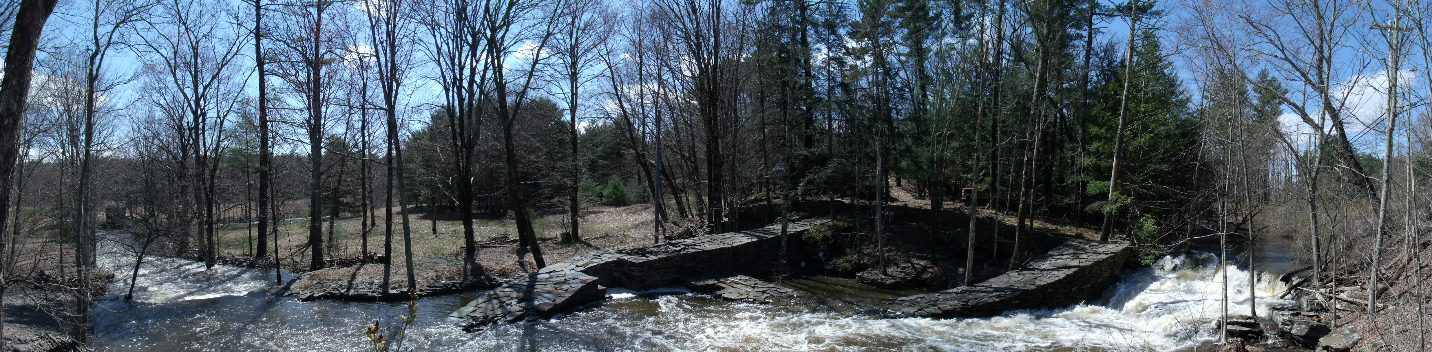
The first landmark is the Highlands and the northeast and northwest zig-zag course through them very familiar to steamboat travelers of Lossing's day. The second is the also familiar dead straight course of the river past Poughkeepsie, the Lange Rack, which by Juet's journal entry is "6 leagues". Lossing's placement of the events in Saugerties would have been based on using the Lange Rack as his measurement key and the head of the Highlands as a starting point for the Half Moon's Sept. 15th, 1609 20 league sailing. That measure would have been what placed this first meeting with "a very loving people" at Saugerties. Others find the events of Robert Juet's journal happening in other places. The discrepancies lie in differing interpretations of the length of the "league" measurement that Henry Hudson was using. Lossing's measurement, based on the Lange Rack between the Danskammer and Crum Elbow, a little less than 14 contemporary mile units, made a league a little more than 2.2 land miles. Other interpretations have used the recognized navigation measures of Hudson's day; the Portuguese Maritime League; that translates to 3.2 nautical miles, and the Italian League, or Geometric League (recently determined to have been the measure used by Columbus) at 2.67 nautical miles. According to statements in the journal the Half Moon sailed 53 leagues and 1 mile up the river. The long boat sounded an additional 8 or 9 leagues farther. Using the Battery as the start point of the river, the Portugese League puts the farthest point up the river the Half Moon reached well above Albany to nearly Whitehall with the longboat reaching a distance equal to Ticonderoga. The 2.67 nautical miles of the Geometric League measure places the Half Moon at Saratoga and the longboat reaching a latitude equal to Lake George. Since the 3.2 mile league makes the Lange Rack stretch from the Danskammer nearly to Kingston and the 2.67 measure makes it reach from the Danskammer well past Esopus Island, neither can be the league that Juet uses for his "6 leagues" documentation. The Lossing interpretation equal to 2.2 land miles to the league is therefore the more logical one for Hudson's sail. The Lossing measure places the Half Moon at Coxackie for the furthest point it reached up the river with the longboat sounding possibly as far as Albany. With this used as the measure all the stops and events of the complete journey of discovery of Henry Hudson in the Hudson Valley can be fairly well placed graphically on this interpretative map.
|
 Robert Juet was a companion of Henry Hudson in his voyages of discovery, and wrote accounts of them. In his narrative of Hudson's third voyage when he discovered our fine river, and in the Half Moon, upon its bosom penetrated the country to the vicinity of Albany, he used the following language in describing the descent of the river from the highest point reached: