 |
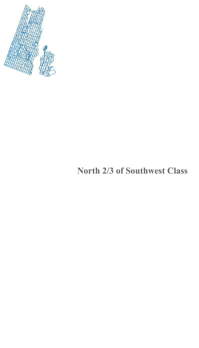
Above (top left): Post Revolution boundaries of the greater Great Knot heritage region when the Commons were divided into Classes and Lots |
|
Land as a Temporal Contrivance |
|
The land and its heritage is part of the Great Knot. As it absorbs the many forgotten facets of the cultural environment it remediates the spirit of the land. It reclaims this along with the material from which it is built to restore pride to the land.
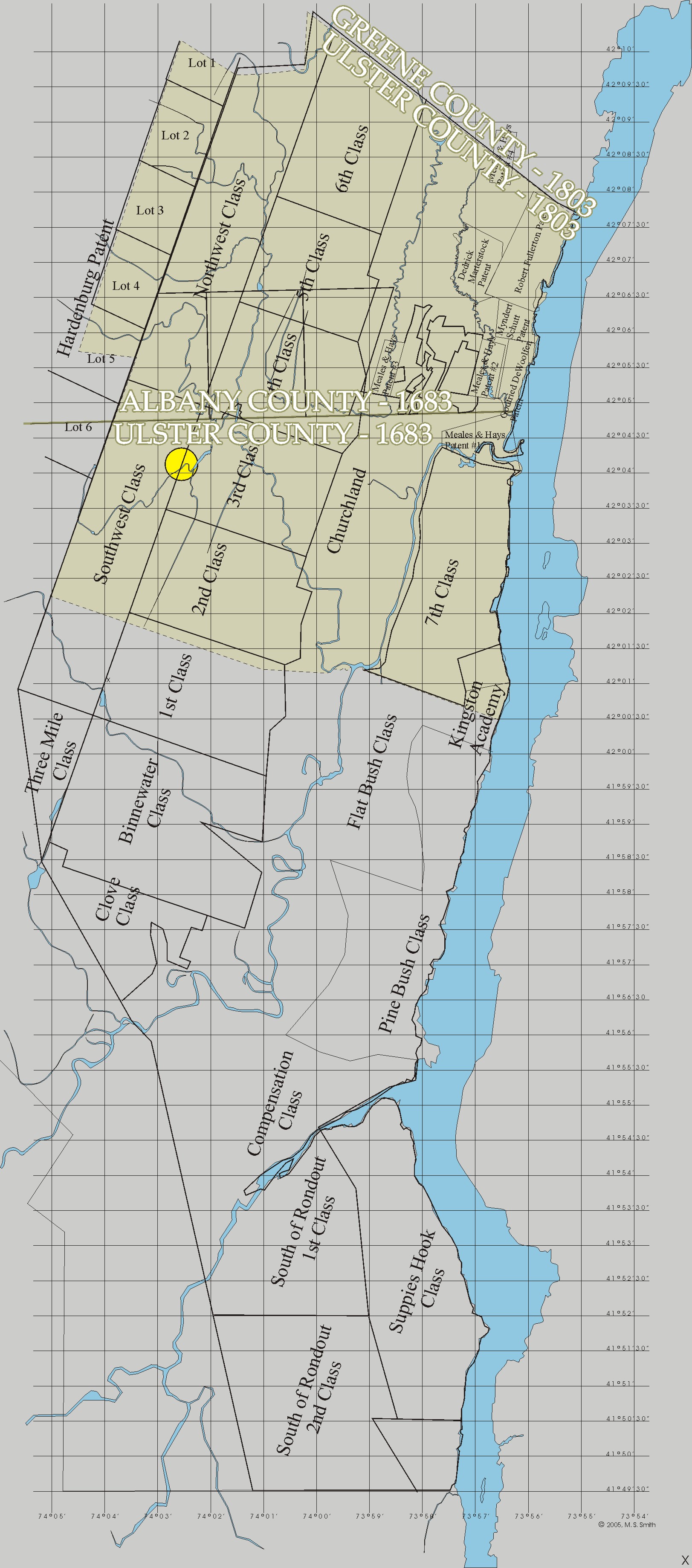
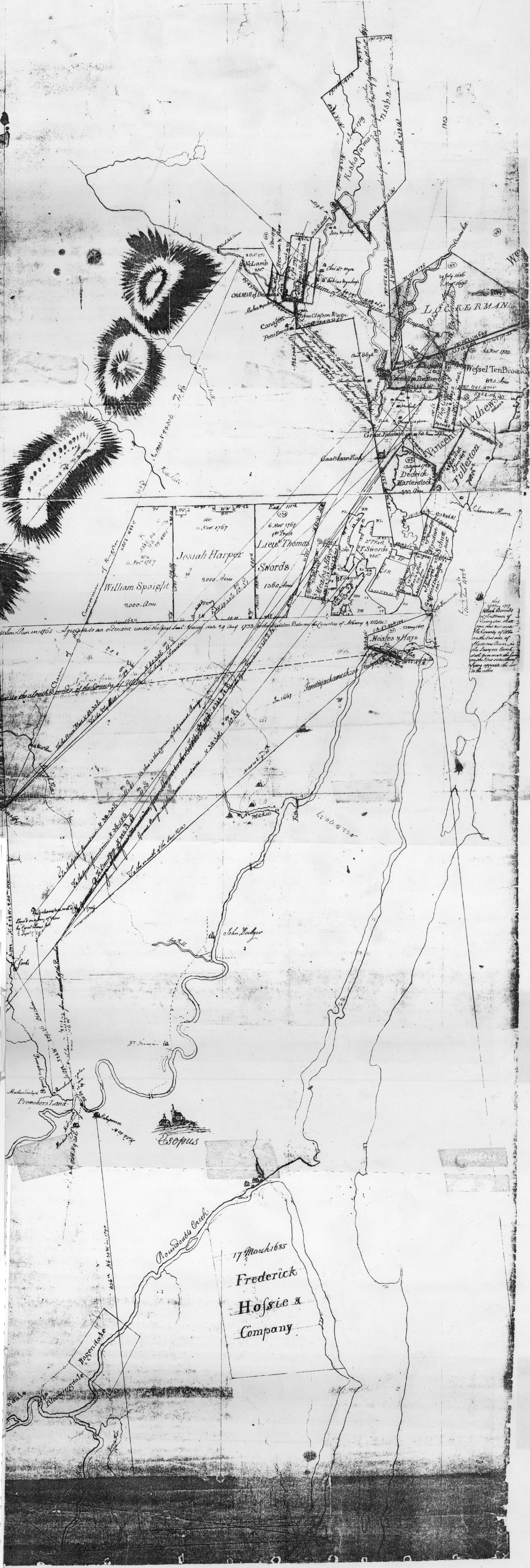
The relationship of the Great Knot to this heritage originates in a reference coded into the boundary description of the Town of Saugerties and recorded with its incorporation to assure that the identity and location of components of the division of the Kingston Commons survived into the future. Today few are aware of the meaning of this two hundred year old record's archaic reference, even though nearly every title to the possession of land began with it.
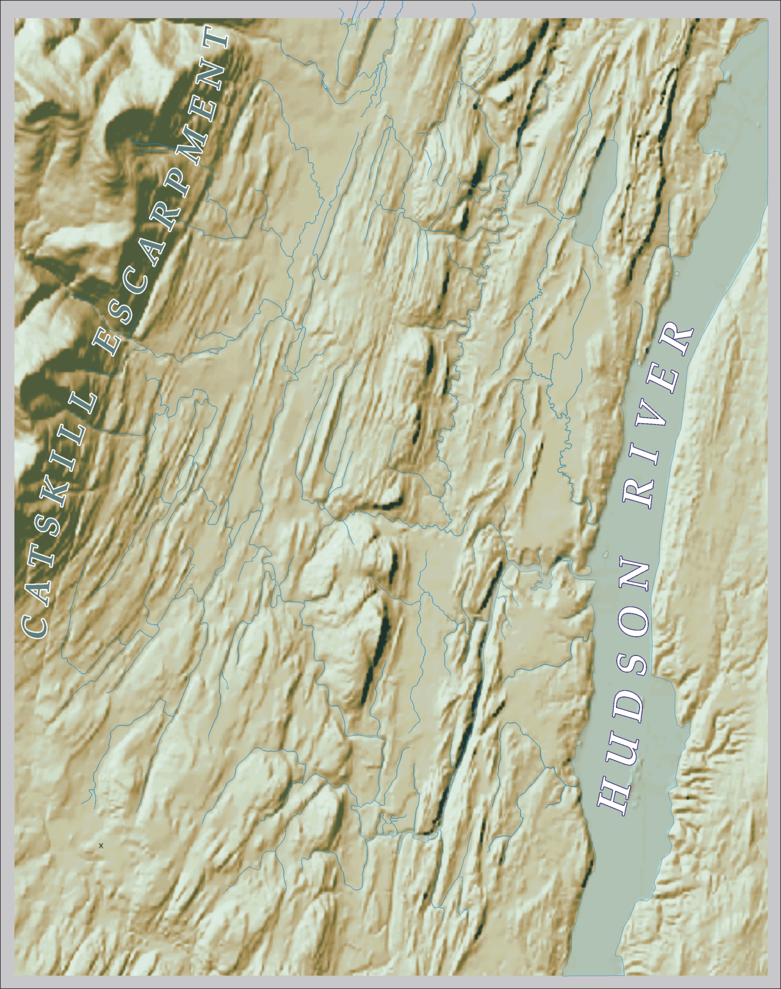
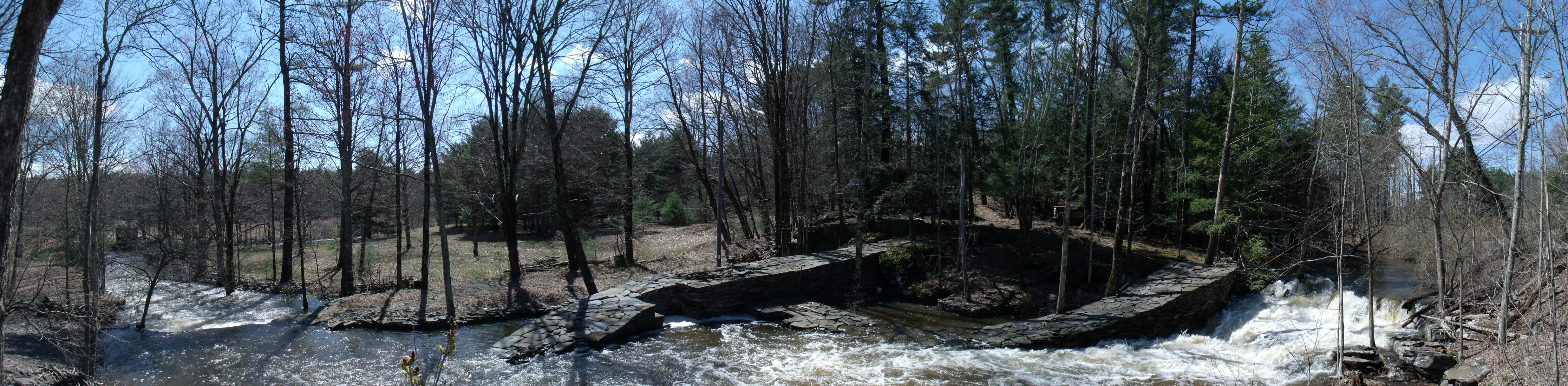
The monumental presence of the Great Knot is built precisely upon the temporal boundary of the Southwest Class. For hundreds of years traffic has been directed past this landmark; the waterfall of the Great Knot; that had long been a symbol of passage.
That waterfall's location is specific. Locations of property boundaries everywhere are relative to where this ancient road has never varied from the side of this waterfall. Rarely has there been a location as pivotal to such a range of site specific aspects over recorded time and the Great Knot emphasizes that.
The maps created for this web site have a cryptic function in this systemic art that the Great Knot acts as a ket to. They integrate the concept of the provenance of the divisions of the land into the concept of the art. The systemic art interprets actual places as temporal parallels to those more transcendental in the knot. The underlying land form has a metaphysical character something like the grid on which the knot relies, so long unnoticed beneath a blanket of possessiveness.
|
 The Great Knot, April 27, 2011 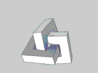 Michael Sullivan Smith, 2015 Click on animation to open parent web site greatknot.com in new browser window |